Trump Towers Hyderabad master plan
The site plan below comes from the earlier drawing set. The current master plan will replace it as soon as the developer releases it.
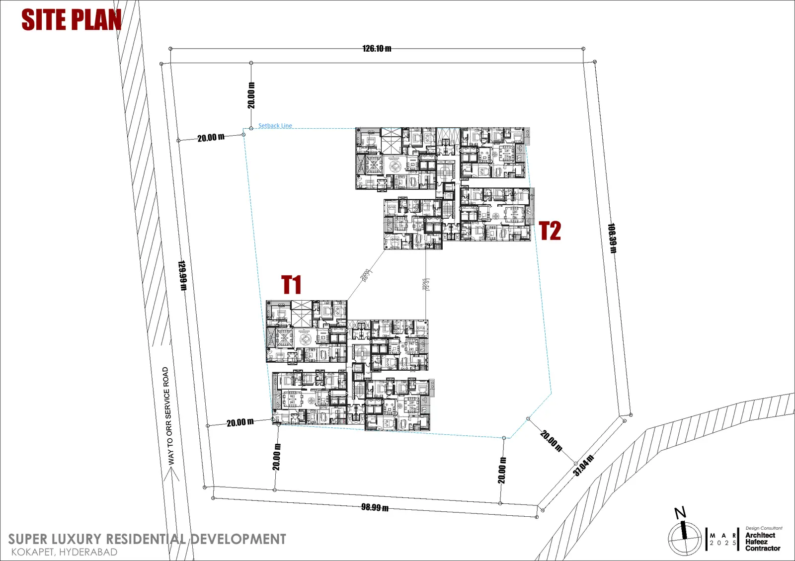
What does the Trump Towers Hyderabad master plan show?
The Trump Towers Hyderabad site plan shows two towers, marked T1 and T2, set diagonally across a plot of 16,389.76 sq. m, about 4.05 acres, at Plot No 7, Golden Mile Road, Kokapet. The built footprint has 20 m setbacks on each side, and access runs to the ORR service road along the western edge. This site plan is from an earlier drawing set, and the current master plan will replace it when the developer releases it.
What the site plan shows
| Element | As drawn |
|---|---|
| Plot boundary | 126.10 m, 108.39 m, 98.99 m, 37.04 m and 129.99 m |
| Setbacks | 20.00 m on each side of the built footprint |
| Towers | Two, marked T1 and T2, set diagonally across the plot |
| Access | Way to the ORR service road along the western edge |
| Recorded land area | 16,389.76 sq. m, about 4.05 acres, per TGRERA |
| Net area after restrictions | 16,246.89 sq. m, per TGRERA |
The diagonal placement is what allows both towers to hold a long face to the open side of the plot rather than looking into each other. It is also what makes the sky bridge at the 28th floor a structural feature rather than a short link.
Setbacks and height context
Kokapet's high rise byelaws under G.O.Ms.50 set setbacks by building height against abutting road width. For buildings above 120 m on a 30 m road, the stipulated setback is 20 m, which matches what is drawn here. Maximum permissible height in this area is separately governed by the Airports Authority of India, and the HMDA layout dossier for Kokapet records a permissible top elevation of 675 m above mean sea level on the adjacent auction parcels.
Ask us for the approved plan set if the exact height clearance matters to your decision.